Testing Development Scenarios for Town-Owned Parcels
Hull is a place that makes you pause. There’s the curve of Nantasket Beach, the ferry to Boston, and now, a big question: how can the town meet its housing needs while preserving the feel of its shoreline community?
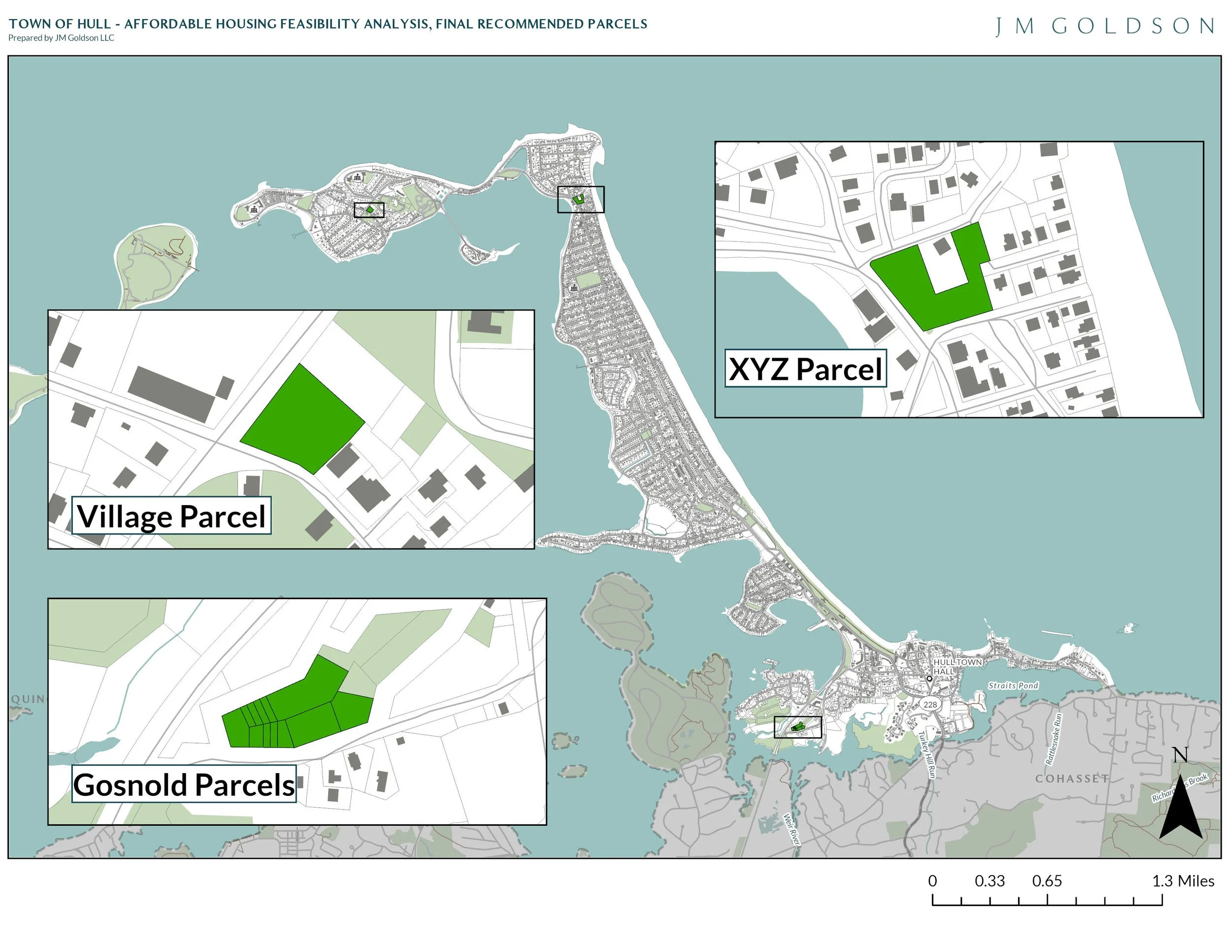
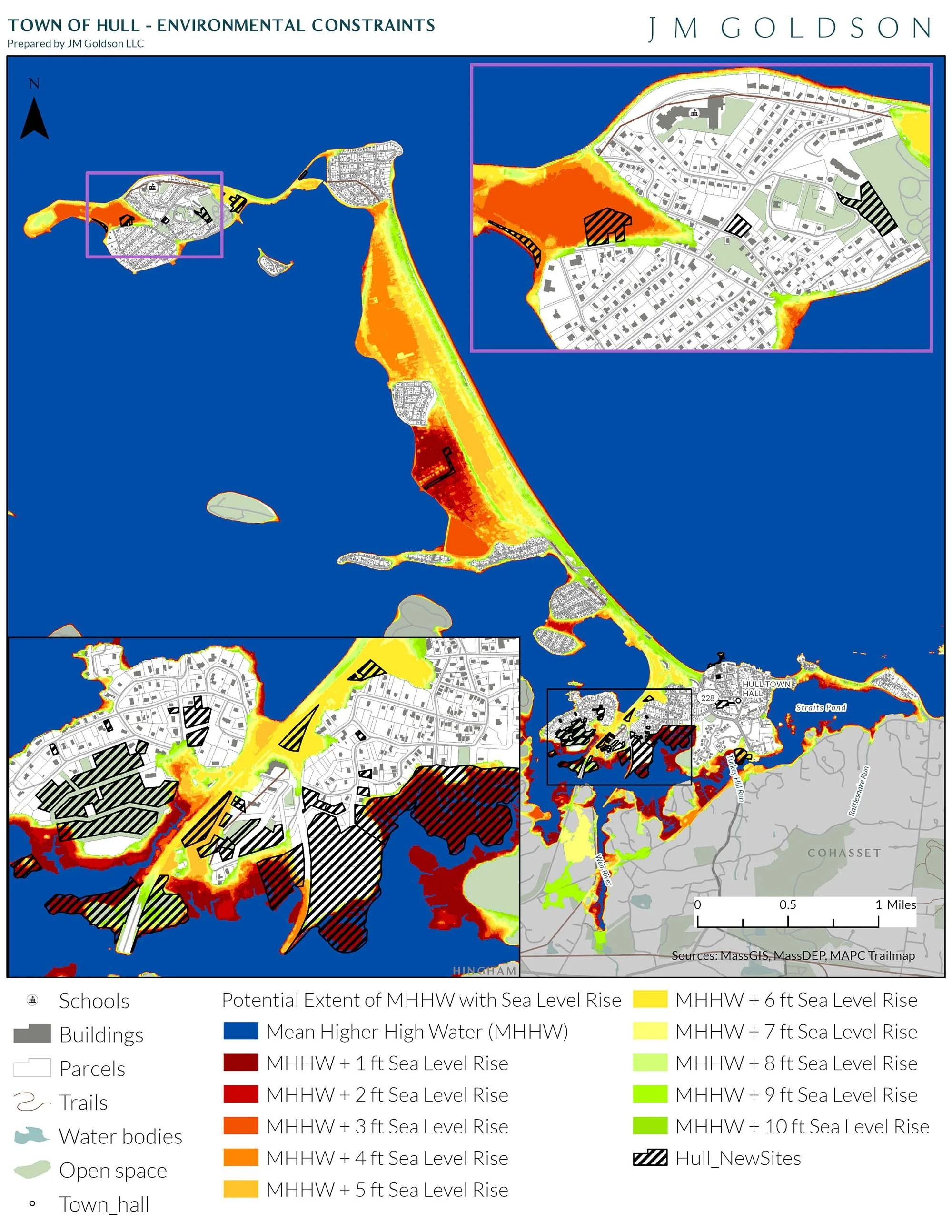
That question came from Hull’s Affordable Housing Committee. With 28 town-owned parcels identified in the Housing Production Plan, our team worked closely with Town staff and the Committee to narrow the list to three with real potential. From there, we combined deep GIS analysis with advanced test fit modeling to ask: what can be built, what would it cost, and could it actually happen?
We studied nine development scenarios across the three sites. The results reflect today’s market: high costs and interest rates make most traditional housing options hard to finance. But one site stood out.
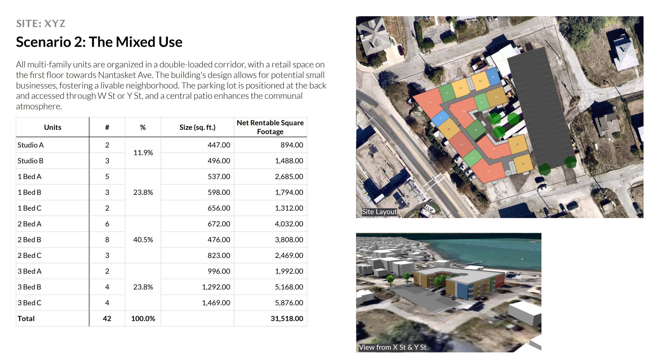
One of the properties (we called it the XYZ parcel) showed promise. A 66-unit apartment building with 25% affordable units could be feasible with no subsidy required. On the smaller Village and Gosnold sites, market-rate development didn’t pencil out. However, all-affordable options showed potential, especially with support from public funding sources.
Throughout the process, we engaged the Committee as thought partners, shaping each scenario in conversation with local priorities. That co-creative approach gave the Town a roadmap rooted in reality, not just aspiration.
Now, Hull faces a meaningful choice. The Town can move forward with a feasible project at XYZ, pursue deeper affordability at Village or Gosnold, or chart a path that includes both.
This is about more than development. It’s about using sound analysis and shared values to plan a future that fits Hull.